Steve  F
Photo: Steve F CC BY-SA 2.0

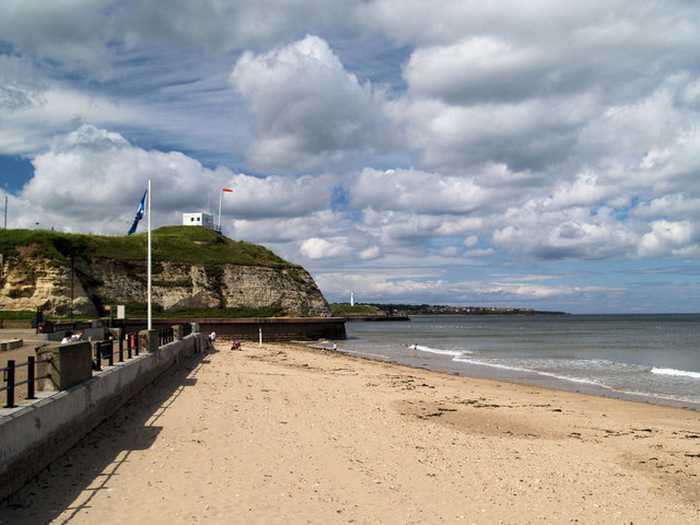
Sunderland Roker Beach

Rating: 0.0/5 (0 votes)

  • Water temp(satellite):
  • 7.2°C
  • 2025-01-21

Weather forecast
Sunderland Roker Beach on the map
Report water temp:

Photos near Sunderland Roker Beach

Martin Burdon mtburdon
Photo: Martin Burdon mtburdon CC0
Mick Garratt 
Photo: Mick Garratt  CC BY-SA 2.0
Mick Garratt 
Photo: Mick Garratt  CC BY-SA 2.0
Do you have a nice picture from Sunderland Roker Beach?
By uploading an image, you certify that you own the image and that it may be displayed on beachexplorer.co.uk

Reviews of Sunderland Roker Beach

No reviews of Sunderland Roker Beach yet...
Please help the next visitor by writing a few lines about the beach, are there toilets? Is it shallow? Is there a jetty or maybe a kiosk?
What do you think of the beach?

Popular beaches near Sunderland

Andrew Curtis
Photo: Andrew Curtis CC BY-SA 2.0
Ryhope East Beach
somaliayaswan
Photo: somaliayaswan CC BY 3.0
Grangetown Beach
Andrew Curtis
Photo: Andrew Curtis CC BY-SA 2.0
Sunderland Hendon South Beach
Roger Smith
Photo: Roger Smith CC BY-SA 2.0
Sunderland Seaburn Beach
Andrew Curtis
Photo: Andrew Curtis CC BY-SA 2.0
Ryhope Beach

Beaches close to Sunderland Roker Beach

Roker - Sunderland ⟼ 0.1 km away
Roker Beach is a gently sloping sandy resort beach approximately 1.5 kilometres in length which lies immediately north of the pier at the mouth of the River Wear. The beach has a road access ramp to the northern end and is backed by a promenade for the southern half.
Sunderland Seaburn Beach ⟼ 1.3 km away
Seaburn - Sunderland ⟼ 1.4 km away
Seaburn Beach is a gently sloping sandy resort beach measuring approximately 1.5 kilometres in length to the north of Sunderland. The beach is backed by a promenade for most of its length.
Grangetown Beach ⟼ 3.8 km away
Sunderland Hendon South Beach ⟼ 4 km away
Marsden Beach ⟼ 5.8 km away
Marsden ⟼ 5.9 km away
Marsden Beach lies in a bay enclosed by steep cliffs. It is rocky and sandy by parts with a gentle slope. Access to the beach is via steps or a lift.
Ryhope Beach ⟼ 6.3 km away
Ryhope East Beach ⟼ 6.4 km away
Seaham Hall Beach ⟼ 8.4 km away
Seaham Hall Beach is a gently sloping resort beach with the designated area measuring approximately 800 metres in length. The beach is mainly sand above the high water mark and a mixture of sand and rock in the inter tidal area. The designated area is in the centre of a two kilometres long bay and the main access to the beach is via stairs. The beach is backed with low cliffs with a promenade at its southern end. Until 2013, it was officially called Seaham beach but the name has been changed to reflect local custom.
Beach explorer UK Source for water samples and information: the Environmental Protection Agency, users of the site and local municipalities.
Source for weather data: Met Éireann© (CC BY 4.0) Disclaimer: Met Éireann does not accept any liability whatsoever for any error or omission in the data, their availability, or for any loss or damage arising from their use.
Source of satellite-read water temperature: Copernicus Sentinel satellite data from the European Space Agency.