Graham Taylor
Photo: Graham Taylor CC BY-SA 2.0

Mount Bay

Rating: 0.0/5 (0 votes)

  • Water temp(satellite):
  • 8.4°C
  • 2025-01-21

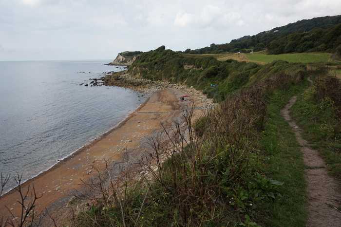
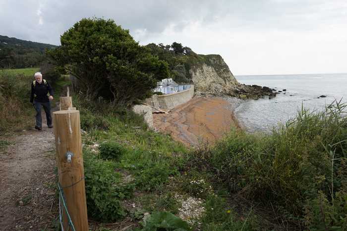
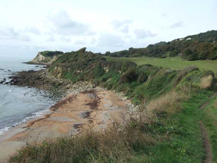
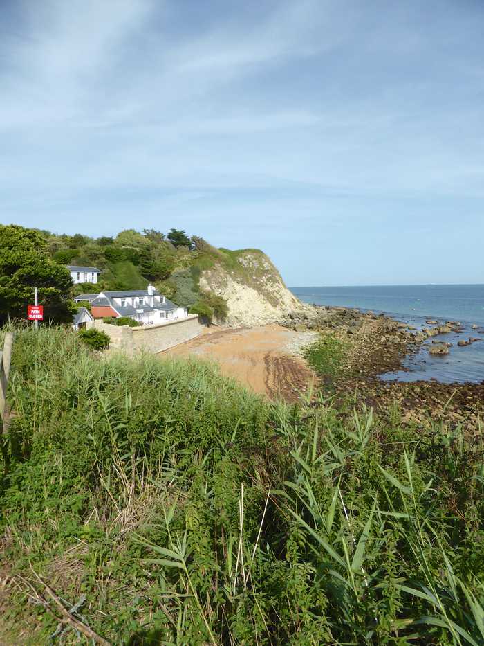
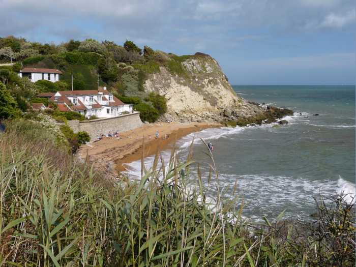
One can embark on a picturesque and adventurous stroll along a precarious clifftop path, ultimately leading to a challenging descent down handmade steps. Upon reaching the destination, a vast shingly beach appears at low tide, accompanied by a meandering stream. This secluded oasis is frequently devoid of any visitors, granting a tranquil and serene environment.

Weather forecast
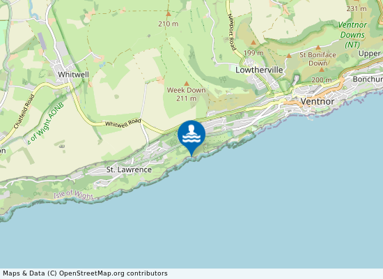
Mount Bay on the map
Report water temp:

Photos near Mount Bay

Ian S 
Photo: Ian S  CC BY-SA 2.0
Ian S 
Photo: Ian S  CC BY-SA 2.0
David Smith 
Photo: David Smith  CC BY-SA 2.0
Thomas from Switzerland
Photo: Thomas from Switzerland CC BY 2.0
Do you have a nice picture from Mount Bay?
By uploading an image, you certify that you own the image and that it may be displayed on beachexplorer.co.uk

Reviews of Mount Bay

No reviews of Mount Bay yet...
Please help the next visitor by writing a few lines about the beach, are there toilets? Is it shallow? Is there a jetty or maybe a kiosk?
What do you think of the beach?

Popular beaches near Isle of Wight

Steve Daniels 
Photo: Steve Daniels  CC BY-SA 2.0
Shanklin Shanklin beach on the south east coast of the Isle of Wight is towards the south of Sandown Bay. The southern half of...
Graham Horn
Photo: Graham Horn CC BY-SA 2.0
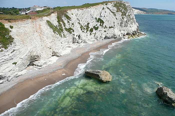
Watcombe Bay Watcombe Bay is a secluded beach that can only be reached through boat or kayak, or by abseiling down from the surrou...
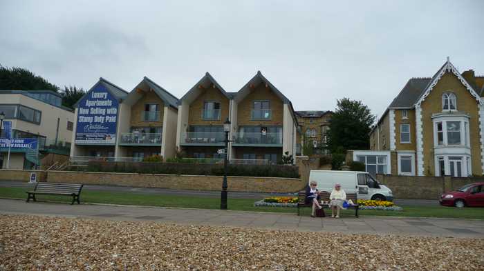
Arriva
Photo: Arriva CC BY-SA 3.0
Cowes To the west of the town, Cowes beach is mostly gravel and slopes into deep water with strong currents. At high tide t...
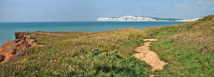
Christine Matthews
Photo: Christine Matthews CC BY-SA 2.0
Compton Bay Hanover Point / Compton Bay is a rural beach on the south west coast of the Isle of Wight. From the foot of the cliff...
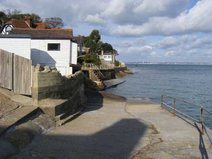
Shaun Ferguson
Photo: Shaun Ferguson CC BY-SA 2.0
Seagrove Seagrove is a small bay situated on the east coast of the Isle of Wight. Measuring less than 1km in length, the bay s...
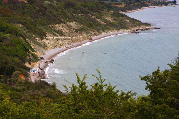
Steve Daniels 
Photo: Steve Daniels  CC BY-SA 2.0
Whitecliff Bay At the eastern tip of the Isle of Wight, Whitecliffe Bay is famous for the well-exposed sedimentary rock sequence whi...
Steve Daniels
Photo: Steve Daniels CC BY-SA 2.0
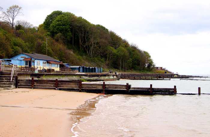
Colwell Bay Colwell Bay is a small resort situated on the north west coast of the Isle of Wight with panoramic views of the Solen...
Graham Horn
Photo: Graham Horn CC BY-SA 2.0
Bembridge Beach

Beaches close to Mount Bay

Orchard Bay ⟼ 0.2 km away
This charming beach is privately owned, but is accessible to the public. However, visitors are kindly reminded to maintain a clean environment by not leaving any litter, such as crisp packets, behind. Furthermore, organizing large gatherings such as raves is prohibited. The journey towards the beach is an enjoyable and adventurous one, as it requires a pleasant 10-minute walk, including steep steps and clambering over rocks. Nonetheless, it might not be the ideal location for a family outing with young children due to the rugged terrain.
Steephill Cove ⟼ 0.8 km away
The beach we're discussing is aptly named due to its steep slope for accessibility. It presents an inviting location for swimming with creature comforts such as available restrooms and a pleasant café nearby. Occasionally, the beach does get rather crowded, giving off a Cornish vibe. It's important to note that dogs are only permitted if they are leashed. Additionally, the beach can be accessed through a lovely coastal walk from Ventnor with plenty of hills to give you a great workout.
Ventnor ⟼ 1.9 km away
Ventnor Bay is a small resort beach situated on the south coast of the Isle of Wight. Measuring 300m in length, the part sand, part fine shingle beach slopes gently into the sea. There are many hidden rocks and the tide is very strong. Adjacent to the beach are pubs, cafes, amusements, paddling pool and seafront car park. Please note that, during the summer months (May to September), dogs are not permitted in the area.
Binnel Bay ⟼ 2.3 km away
This shoreline may not offer an easy entry or a suitable spot for swimming. Furthermore, it is studded with stones and presents challenges for those walking on its surface. The absence of amenities adds to its rustic charm, making it a secluded and serene destination for those seeking solitude or a romantic getaway. The beach's desolate nature may be an apt source of inspiration for those passionate about penning melancholic tunes. Visitors should be aware that this area does not host any entertainment or gaming venues.
Wheelers Bay ⟼ 3.3 km away
Bonchurch to Ventnor offers a lovely walk that is easily accessible via a wheelchair or pushchair. However, it should be noted that there is a steep hill leading up to the Shore Road car park. During the winter months, the tide frequently reaches the sea wall, resulting in spectacular crashing waves. It is not advisable to swim at this beach due to the strong sea currents. Toilets are available at the Bonchurch end of the beach.
Reeth Bay ⟼ 3.8 km away
This serene beach lies in a remote location and boasts quaint boats and a rugged seawall. The beach is bordered by dense woodlands, providing a picturesque backdrop for visitors. During high tide, there may be limited space for beachgoers (as shown in photos). Although lacking in facilities, the beach can be easily accessed via a well-maintained road. It is also referred to as Castlehaven.
Watershoot Bay ⟼ 5.1 km away
The secluded rocky beach can be found by traversing a complex network of footpaths from Old Blackgang Road Car Park, although accessing it from St. Catherine's Lighthouse may be the smoother route. Due to its limited accessibility, it is entirely possible to have this beach all to oneself. This feature makes it a suitable location for introspective activities such as contemplating past memories of a previous relationship.
Blackgang Beach ⟼ 5.3 km away
Nestled between Blackgang and Rocken End, there lies a stunning shingle beach that many locals refer to as both Blackgang and Rocken End beach. To reach this hidden gem, one must venture down an unofficial and muddy pathway from Old Blackgang Road Car Park. As cautionary advice, be prepared for a slippery descent that may result in a comical tumble just moments after your partner questions the wisdom of the trek. Blackgang Beach is a popular destination for sun-seekers who desire a full-body tan as this secluded section of shoreline offers the perfect retreat for those who wish to bask in the sun without prying gaze.
Shanklin ⟼ 6.2 km away
Shanklin beach on the south east coast of the Isle of Wight is towards the south of Sandown Bay. The southern half of the sandy beach slopes gently up to the cliffs with a rock ledge at its extremity and the northern half is backed by the resort's esplanade. The beach is popular with anglers.. A stream flows to the beach from Shanklin Chine. Shanklin is an excellent destination for families seeking a traditional seaside day out, complete with sandy beaches and fun amenities like mini golf and bouncy castles available during peak season. The esplanade is also well-equipped with toilets, paid parking, and a wide variety of dining options. Additionally, visitors can take advantage of the lift which provides access to the clifftop. It's important to note that dogs are not allowed on the beach between May and September, with the exception of a designated section near Lake.
Whale Chine ⟼ 7.5 km away
Although the beach has become somewhat inaccessible from the top due to erosion, it can still be reached by walking along from nearby beaches. Once you arrive, you will be awestruck by the stunning high cliffs that offer magnificent views into the vast expanse of the ocean. This secluded beach is a haven for those seeking solitude, and it is rare to encounter other individuals in the area. As a result, it is the perfect destination for both hermits and angsty teenagers looking for a peaceful and undisturbed escape.
Beach explorer UK Source for water samples and information: the Environmental Protection Agency, users of the site and local municipalities.
Source for weather data: Met Éireann© (CC BY 4.0) Disclaimer: Met Éireann does not accept any liability whatsoever for any error or omission in the data, their availability, or for any loss or damage arising from their use.
Source of satellite-read water temperature: Copernicus Sentinel satellite data from the European Space Agency.